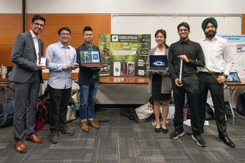
Kamran Alam, Vicky Chen, Manvir Dhami, Zoeb Gaurani, Harman Sihota and Yitong Tang
- Community Partner: Korotu Technology
- Degree: Bachelor of Applied Science
- Program:
- Campus: Vancouver
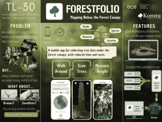
Our design solution
Making evidence-informed decisions requires data. For forest management, that has traditionally involved sending trained surveyors into often remote forest locations to take measurements of tree height, diameter and location – a costly and time-consuming endeavour. More recently, drones and satellites have been used. Yet these technologies are unable to collect quality data below the forest canopy, consequently missing out on growth hidden underneath the tree cover.
Our app, ForestFolio, simplifies and streamlines the data collection process.
It combines the tools used by traditional surveyors into one device, relying on a smartphone’s camera, LiDAR sensor, gyroscope and accelerometer to collect data.
First, users walk around the forest plot and perform a LiDAR scan of their surroundings to generate a map of the detected trees within the plot area. Machine learning algorithms automatically detect trees with a diameter of more than nine centimetres, then estimate the diameter of each detected tree. Next, users are guided through a simple process for measuring tree height, which is calculated by measuring the angle from the ground to the top of the tree. This step includes an augmented reality feature to help users orient themselves and reduce error.
This information is then uploaded to the server for additional analysis.
The challenges we faced
There are some standalone apps that did elements of what we wanted, but very few were open source. This required us to do research, build our own knowledge base and develop our own methods. There were also challenges in finding the APIs and technologies that would enable us to achieve our goals, and iOS is notorious for not having support for many of the libraries we use.
Integrating each component into one application also had its challenges. In fact, we’re not sure if anyone has integrated these specific elements before!
Our project’s future
Our client was very happy with our work and ability to achieve the project goals.
Features for future iterations would include the ability to work in a truly remote location (our version does require a GPS signal), collect data for different plot shapes and sizes, and automatically detect tree species. Additionally, the app could support a wider range of mobile devices, as the current version is limited to certain iPhone Pro devices that are equipped with the LiDAR sensor.